 JOGLP
Part of the route John o' Groats → Lizard Point
Limestone Way & Staffordshire Way
Castleton → Knighton
- Length
- 219km
- typical days
- 6–9
- Ascent
- 3,106m ↑
- Wild camping
- mostly not
What to expect
From Castleton the “mountains” are over for a while. The Pennine Way is behind you, and from here you head south through wide, fairly flat rolling country. This isn’t one continuous long-distance path but a stretch of the Limestone Way, a stretch of the Staffordshire Way and, in between, paths we pieced together ourselves. To be honest, this was the section we’d planned least, and we didn’t really know what to expect. So we were quite surprised that the Limestone Way even existed.
Don’t expect wilderness here. You’re always close to villages and farms, and essentially you’re bridging the heavily farmed country between the Peak District and the Welsh border, where the Offa’s Dyke Path awaits. It’s still nice. Because it’s fairly flat you can really cover distance, and that’s what we’d recommend: don’t spend too long here.
Limestone Way and Dovedale: The Limestone Way runs around 74 km through the White Peak from Castleton to Rocester in Staffordshire (Wikipedia). On the very first day you walk through Monk’s Dale, a narrow, deep and rather overgrown limestone valley that is part of a nature reserve (gov.uk), sometimes easy going, sometimes less so. After that we walked a stretch of the Tissington Trail, a railway line from 1899 that has been a cycling and walking path since 1971 (Peak District National Park). Flat as a pancake; we just wanted to cover some kilometres. In the evening you drop down near Milldale into Dovedale, with its crystal-clear river, tall limestone cliffs and old villages. It’s beautiful, but very touristy where it’s easy to reach. At spots like “Lover’s Leap” there were still surprisingly many people around late in the evening. No wonder, it really was romantic.
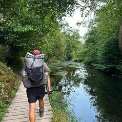
Staffordshire and Shropshire: After that it gets quieter. Wide hills, lots of farmland, more woodland, and small canals with locks now and then, for example near Penkridge. In between it gets surprisingly wild. Near Rugeley you skirt Cannock Chase, the largest surviving area of heathland in the Midlands (National Landscapes), with bracken and heather; at times it felt almost like the Lüneburg Heath where Patrick is from. And because there’s no continuous long-distance trail, you sometimes end up on paths that only exist on the map. Once we had to properly fight our way through the undergrowth because the path had completely disappeared in real life; more of an expedition through the rainforest. This was the section where we’d least expected that. The weather didn’t always play along either. The villages are close together and you pass shops regularly, even a Lidl (a treat after weeks of Co-op range).
Sick break and train: Shortly before the end it caught up with us: a stomach bug for Lorenz, a foot tendon problem for Patrick. So we only walked as far as Cosford station, took the train to Shrewsbury and had a good day’s rest there. Shrewsbury is a lovely little town, by the way. From there we took the Heart of Wales line via Craven Arms to Knighton (Wikipedia), where the Offa’s Dyke Path continues. So we didn’t walk the stretch in between via Ironbridge, Wenlock Edge and Craven Arms ourselves; the route covers it on foot on waymarked paths. We can’t tell you from experience what it’s like.
Our verdict: Nice enough overall, but we wouldn’t walk this section as a trip of its own. It’s the bridge between two really good trails.
Elevation profile
Caution
- Dovedale is popular and busy well into the evening. You’re more likely to find a quiet pitch before it or a bit after.
- From Staffordshire on you’re mostly crossing fields and pasture. Close gates behind you and give cows with calves a wide berth.
- Some paths, for example in Monk’s Dale, are badly overgrown in summer, and some only exist on the map. Long trousers help, and allow some time for detours.
- Waymarks are of little help, because you’re only on official trails in pieces. Have the route as a GPX on your phone.
- We didn’t walk the stretch from Cosford to Knighton. The GPX follows waymarked paths there; things on the ground may differ.
Suggested stages
- 1Castleton → Monyashkm 0.0–24.224.2km · 520 m ↑
4 shops · 2 huts/hostels · 1 station · 2× drinking water
- 2Monyash → Swinscoekm 24.2–47.923.7km · 279 m ↑
1 shop · 2 huts/hostels · 4× bus · 3× drinking water
- 3Swinscoe → Marchington Woodlandskm 47.9–72.925.0km · 193 m ↑
2 shops · 1 station
- 4Marchington Woodlands → Broctonkm 72.9–97.324.4km · 236 m ↑
3 shops · 1 station
- 5Brocton → Boscobelkm 97.3–121.324.0km · 120 m ↑
2 shops · 1 station · 1× drinking water
- 6Boscobel → Ironbridgekm 121.3–145.123.8km · 210 m ↑
2 shops · 1 hut/hostel · 2 stations
- 7Ironbridge → Rushburykm 145.1–167.622.5km · 522 m ↑
1 shop · 2 huts/hostels · 1× bus
- 8Rushbury → Aston on Clunkm 167.6–192.725.1km · 350 m ↑
3 shops · 1 station
- 9Aston on Clun → Knightonkm 192.7–218.726.0km · 676 m ↑
1 shop · 5 stations
- 1Castleton → Newhavenkm 0.0–32.432.4km · 622 m ↑
5 shops · 2 huts/hostels · 1 station · 4× drinking water
- 2Newhaven → Crakemarshkm 32.4–63.531.1km · 270 m ↑
2 shops · 2 huts/hostels · 6× bus · 1× drinking water
- 3Crakemarsh → Broctonkm 63.5–97.333.8km · 336 m ↑
4 shops · 2 stations
- 4Brocton → Neachleykm 97.3–128.931.6km · 120 m ↑
3 shops · 2 stations · 1× drinking water
- 5Neachley → Easthopekm 128.9–161.432.5km · 604 m ↑
2 shops · 1 hut/hostel · 1 station
- 6Easthope → Aston on Clunkm 161.4–192.731.3km · 478 m ↑
3 shops · 1 hut/hostel · 1 station
- 7Aston on Clun → Knightonkm 192.7–218.726.0km · 676 m ↑
1 shop · 5 stations
- 1Castleton → Milldalekm 0.0–39.039.0km · 632 m ↑
5 shops · 3 huts/hostels · 1 station · 4× drinking water
- 2Milldale → Abbots Bromleykm 39.0–78.939.9km · 405 m ↑
2 shops · 2 huts/hostels · 1 station · 1× drinking water
- 3Abbots Bromley → Boscobelkm 78.9–121.142.2km · 311 m ↑
5 shops · 2 stations · 1× drinking water
- 4Boscobel → Easthopekm 121.1–161.440.3km · 604 m ↑
3 shops · 1 hut/hostel · 2 stations
- 5Easthope → Hopton Castlekm 161.4–198.537.1km · 586 m ↑
3 shops · 1 hut/hostel · 3 stations
- 6Hopton Castle → Knightonkm 198.5–218.720.2km · 568 m ↑
1 shop · 4 stations
Sleeping out
In England and Wales you officially need the landowner's permission to pitch a tent. It's often tolerated anyway if you behave: people there love walking, many have done long routes themselves, and we nearly always met helpfulness. These are the ground rules we stuck to.
Wild camp spots: it varies
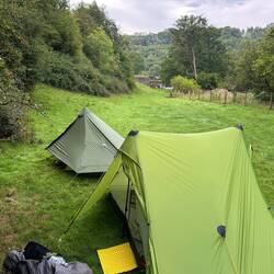
In England you officially need the landowner’s permission to wild camp (UKClimbing). In the Peak District you can still find a spot quite easily, then it slowly gets harder. Almost everything here is pasture and fields, and you’re rarely far from a farm. What worked best for us were empty cow fields tucked away between hedges, hoping no farmer would turn up and complain. After Dovedale and a long day, the only option left was the far end of a cow and sheep field (luckily no cows came to visit). In August the ground was rock hard and the pegs barely went in.
Our ground rules for wild camping
- Pitch late, when it gets dark.
- Pack up early, before it is fully light.
- Stay out of sight – if nobody sees you, nobody minds.
- Respect fences and walls.
- Don't disturb animals – never camp in fields with livestock.
- Leave no litter, pack everything out. For human waste dig a deep hole well inside the woods; bury toilet paper deep or take it with you.
- No fires – gas stove only.
- Don't damage anything – no cutting trees, no flattening plants.
- Leave no trace.
- If someone asks you to leave, leave. Usually you can talk to people – show that you take their concerns seriously and you are more likely to get help. We never had a bad experience.
- In short, don't be a dick. It's just common sense, really.
Shops & water
km 33–60: no shop for 27 km – carry enough food.
km 153–181: no shop for 28 km – carry enough food.
km 193–219: no shop for 26 km – carry enough food.
Trains & buses along the trail
Train Cosford → Knighton · on foot instead of train/bus: 92.2 km
Plus buses at 20 places along the way – on the map under “Train & bus” (one point per town).
In an emergency: 999 or 112
In the hills, ask for "Police", then "Mountain Rescue". Note down first: your location (coordinates from your map app), who is hurt and how, how many of you there are, your mobile number. Then stay where you are until the rescue team contacts you. More →
Data © OpenStreetMap contributors, as of November 2026 – check locally.
How it went for us
4 days in 2025 · route, GPX and our travel diary
45.9 km · 652 m ↑
Camp 34
Full day →GPX ↓FindPenguins ↗35.5 km · 402 m ↑
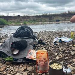
Lunch am Fluss · Camp 35
Full day →GPX ↓FindPenguins ↗35.3 km · 254 m ↑
Schleuse für Size Zero Boote · Endlich mal wieder Regen · Endlich mal wieder Urwald · Camp 36
Full day →GPX ↓FindPenguins ↗10.8 km · 52 m ↑
Camp 37
Full day →GPX ↓FindPenguins ↗
Found a mistake or have a question about this trail? Email us