 JOGLP
Part of the route John o' Groats → Lizard Point
Offa's Dyke Path (Knighton – Chepstow)
Knighton → Chepstow
- Length
- 135km
- typical days
- 4–6
- Ascent
- 2,963m ↑
- Wild camping
- mostly not
What to expect
Offa’s Dyke Path is a National Trail that runs around 285 km from Prestatyn on the north coast of Wales to Sedbury near Chepstow, roughly following the border between England and Wales (Wikipedia). It’s named after Offa’s Dyke, an 8th-century earthwork attributed to King Offa of Mercia (Wikipedia). To be honest, we didn’t really know what to expect; we’d only heard it was beautiful. And that’s exactly the impression we had from the very start. We only walked the southern half, from Knighton to Chepstow, in four days. Looking back, that’s a real shame, and we can’t judge the northern part.
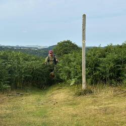
This is picture-book Wales, with hills, sheep, lots of open country, then more hills and sheep. You often walk along the ridges and get great views all around. The trail is very well waymarked, and phone signal was never really a problem for us. Every now and then you come across semi-wild ponies, at the latest in the Black Mountains.
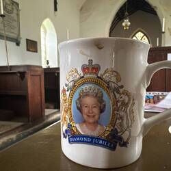
Churches: From here on you notice how many churches there are along the way, and in many of them you’ll find water, tea or coffee for a small donation. People in Scotland had told us about it, and we tried it for the first time in Newchurch. At some point we’d seen more churches from the inside than pubs. We’d really recommend it. The churches are often lovely, with old churchyards and buildings, and the people there are delighted to hear about your adventure and happy to help if you have questions or problems.
Knighton to Hay-on-Wye: The first stretch to Kington is short and a good way to get going. Then you cross Hergest Ridge, an open ridge with wide views (and wind). Via Newchurch you reach Hay-on-Wye, a good place for a lunch break and shopping.
Black Mountains: Beyond Hay-on-Wye comes a really steep climb up Hay Bluff, a proper mountain stage. On top you walk for many kilometres along Hatterrall Ridge, constantly above 500 m; the highest point of the whole trail is here at 703 m (Wikipedia). The views are huge and ponies graze everywhere. But it’s completely open, with no trees, no hollows and hardly any shelter from the wind. You’re at the mercy of the weather.
The south: After that you drop down into farmland and the “rolling hills”. Sounds relaxing, but it’s a constant up and down that we really had to fight our way through. Over the Kymin near Monmouth, with a wide view across the valley, you get one last really beautiful valley at the end: that of the River Wye, which you’ve already crossed at Hay-on-Wye. Here you walk along the western edge of the Forest of Dean. If the area looks familiar, the Wye valley is one of the backdrops of the Netflix series “Sex Education” (Visit Dean Wye), which is exactly where we knew it from. According to our data, though, there’s no shop right on the trail for around 50 km between Hay-on-Wye and Monmouth.
Our verdict: We thought Offa’s Dyke Path was brilliant, and it still bugs us a little that we didn’t walk all of it; the northern part would surely have been great too. For us this is the trail you really should do in Britain if you’ve already done the West Highland Way or found it too touristy. We may well come back one day for the whole thing. The price, by the way, was skipping the Cotswolds and the Cotswold Way with its pretty villages of honey-coloured limestone (Wikipedia). If you’re at this point of the route, think about which you’d prefer. We’d recommend Offa’s Dyke any time.
Coming to Knighton: After our sick break in Shrewsbury we took the train to Knighton and stocked up at the Co-op there. Onwards south: In Chepstow Offa’s Dyke ends, and you cross the River Severn back into England. We’d actually planned to walk over the Severn Bridge; after the bridge at Inverness it would have been a nice transition. But locals advised against it: the area along the estuary is densely built up, fairly industrial and not particularly nice. On top of that, the station beyond the bridge wasn’t being served because of engineering works. So from Chepstow we took the train through the tunnel straight to Bristol, where we’d planned a rest day anyway. We can’t judge the stretch in between, but it felt like the right call.
Elevation profile
Caution
- Hergest Ridge and the Black Mountains ridge are open and windy; on the ridge you’re above 500 m for many kilometres. Check the weather first, look for a pitch early and guy your tent out well.
- The climb up Hay Bluff beyond Hay-on-Wye is steep. Take enough water and food, there’s nothing up there.
- Between Hay-on-Wye and Monmouth there’s no shop right on the trail for around 50 km. The churches help with water, but stock up beforehand.
- The rolling hills in the south are a constant up and down. Allow some extra time when planning your days.
- If you want to walk over the Severn Bridge from Chepstow and take a train on the other side, check that the station is being served first. When we were there it was closed for engineering works.
Suggested stages
- 1Knighton → Kingtonkm 0.0–22.522.5km · 727 m ↑
1 shop · 1 hut/hostel · 1 station
- 2Kington → Hay on Wyekm 22.5–48.826.3km · 621 m ↑
2 shops · 1 hut/hostel · 1× bus · 1× drinking water
- 3Hay on Wye → Stantonkm 48.8–74.826.0km · 738 m ↑
1 shop · 2× bus
- 4Stanton → Worthybrookkm 74.8–97.722.9km · 394 m ↑
1× bus · 2× drinking water
- 5Worthybrook → Tinternkm 97.7–122.424.7km · 349 m ↑
3 shops · 6× bus · 2× drinking water
- 6Tintern → Chepstowkm 122.4–134.912.5km · 134 m ↑
1 shop · 1 station · 2× drinking water
- 1Knighton → Gladestrykm 0.0–32.132.1km · 1,045 m ↑
2 shops · 1 hut/hostel · 1 station
- 2Gladestry → Capel-y-ffinkm 32.1–62.029.9km · 961 m ↑
2 shops · 1× bus · 1× drinking water
- 3Capel-y-ffin → Llanvihangel Ystern Llewernkm 62.0–93.731.7km · 420 m ↑
2× bus · 2× drinking water
- 4Llanvihangel Ystern Llewern → Tidenham Chasekm 93.7–125.732.0km · 434 m ↑
3 shops · 6× bus · 4× drinking water
- 5Tidenham Chase → Chepstowkm 125.7–134.99.2km · 103 m ↑
1 shop · 1 station · 1× drinking water
- 1Knighton → Newchurchkm 0.0–37.237.2km · 1,206 m ↑
2 shops · 1 hut/hostel · 1 station
- 2Newchurch → Pandykm 37.2–76.439.2km · 880 m ↑
2 shops · 3× bus · 1× drinking water
- 3Pandy → Pen Y Fankm 76.4–115.439.0km · 710 m ↑
2 shops · 5× bus · 4× drinking water
- 4Pen Y Fan → Chepstowkm 115.4–134.919.5km · 167 m ↑
2 shops · 1 station · 2× drinking water
Sleeping out
In England and Wales you officially need the landowner's permission to pitch a tent. It's often tolerated anyway if you behave: people there love walking, many have done long routes themselves, and we nearly always met helpfulness. These are the ground rules we stuck to.
Wild camp spots: it varies
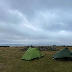
Wild camping on Offa’s Dyke is quite possible, but here too, take the spots as they come. On Hergest Ridge and the Black Mountains ridge there are hardly any sheltered, level spots. Both nights we had to pitch completely exposed, and both times it was stormy; on the second night Patrick’s tent nearly blew away. Restful sleep was in short supply, but the view in the morning was beautiful. Down in the farmland it’s like Staffordshire again, with fields, hedges and farms. Officially you need the landowner’s permission in Wales too (UKClimbing).
Our ground rules for wild camping
- Pitch late, when it gets dark.
- Pack up early, before it is fully light.
- Stay out of sight – if nobody sees you, nobody minds.
- Respect fences and walls.
- Don't disturb animals – never camp in fields with livestock.
- Leave no litter, pack everything out. For human waste dig a deep hole well inside the woods; bury toilet paper deep or take it with you.
- No fires – gas stove only.
- Don't damage anything – no cutting trees, no flattening plants.
- Leave no trace.
- If someone asks you to leave, leave. Usually you can talk to people – show that you take their concerns seriously and you are more likely to get help. We never had a bad experience.
- In short, don't be a dick. It's just common sense, really.
Shops & water
km 50–102: no shop for 52 km – carry enough food.
Trains & buses along the trail
Train Chepstow → Bristol
Bus Bristol → Lower Langford
Plus buses at 13 places along the way – on the map under “Train & bus” (one point per town).
In an emergency: 999 or 112
In the hills, ask for "Police", then "Mountain Rescue". Note down first: your location (coordinates from your map app), who is hurt and how, how many of you there are, your mobile number. Then stay where you are until the rescue team contacts you. More →
Data © OpenStreetMap contributors, as of November 2026 – check locally.
How it went for us
4 days in 2025 · route, GPX and our travel diary
- Day 36 · 6 AugKnighton → Kington☁️ 17 °C
29.0 km · 1,017 m ↑
Weiter geht es in Knighton · Rushock Hill · Camp 38
Full day →GPX ↓FindPenguins ↗ 38.8 km · 1,014 m ↑
Pause in Newchurch · Lunch in Hay on Wye · Black Mountain · Camp 39
Full day →GPX ↓FindPenguins ↗38.7 km · 738 m ↑
Kaffeepause · Camp 40
Full day →GPX ↓FindPenguins ↗29.3 km · 229 m ↑
The Kymin · The Valley · The Tunnel · The Bridge · Camp 41
Full day →GPX ↓FindPenguins ↗
Found a mistake or have a question about this trail? Email us